

UFII Fellows Journal Club Virtual Seminar – Daniele Pinton

- This event has passed.
UFII Fellows Journal Club Virtual Seminar – Daniele Pinton
March 11, 2021 @ 12:30 pm - 1:30 pm
UFII Fellows Journal Club Virtual Seminar Series
“A new algorithm for estimating ground elevation and vegetation characteristics in coastal salt marshes from high-resolution UAV-based LiDAR
point clouds”
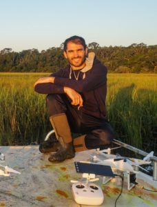
by Daniele Pinton
PhD Student in the Department of Civil and Coastal Engineering
Thursday, March 11, 2021
ABSTRACT:
Salt marshes are transitional zones between ocean and land, which act as natural buffers against coastal hazards. The survival of salt marshes is governed by the rate of organic and inorganic deposition, which strongly depends on vegetation characteristics, such as height and density. Vegetation also favors the dissipation of wind waves and storm surges. For these reasons, an accurate description of both ground elevation and vegetation characteristics in salt marshes is critical for their management and conservation. For this purpose, airborne LiDAR (light detection and ranging) laser scanning has become an accessible and cost-effective tool to map salt marshes quickly. However, the limited horizontal resolution (~1m) of airborne-derived point clouds prevents the direct extraction of ground elevation, vegetation height, and vegetation density without the coupling with imagery datasets. Instead, due to the lower flight altitude, UAV (unmanned aerial vehicle)-borne laser scanners provide point clouds with much higher resolution (~5cm). Although methods for estimating ground level and vegetation characteristics from UAV LiDAR have been proposed for flat ground, we demonstrate that a sloping ground increases prediction errors. Here we derive a new formulation that improves the estimation by employing a correction based on a LiDAR-derived estimate of local ground slope. Our method directly converts the 3D distribution of UAV LiDAR-derived points into vegetation density and height, as well as ground elevation, without the support of additional datasets. The proposed formulation is calibrated by using measured density and height of Spartina alterniflora in a marsh in Sapelo Island, Georgia, USA, and successfully tested on an independent dataset. Our method produces high-resolution (40×40cm2) maps of ground elevation and vegetation characteristics, thus capturing the large gradients in the proximity of tidal creeks.
Bio:
Daniele Pinton is a Ph.D. student at the Department of Civil and Coastal Engineering at the University of Florida. He previously got his bachelor’s degree in Civil Engineering in 2015 as well as his master’s degree in Hydraulic Engineering, and his qualification to practice as a Professional Engineer in 2018 at the University of Padova, Italy. After that, he worked as a numerical modeler and hydraulic engineer in an Italian office, collaborating on various local and national projects. Since Spring 2019, Daniele is part of Dr. Canestrelli’s lab, which mainly focuses on improving numerical hydrodynamic and eco-morph dynamic models in coastal, estuarine, and riverine environments. His research primarily focused on implementing a numerical model to forecast the distribution of pollutants in the GTM estuary. For this research, he won a fellowship with the One Health Center of Excellence at the University of Florida in 2019. To improve the efficiency of his high-resolution numerical model, he focused on the use of new technologies, such as high-resolution UAV-based LiDARs, to describe the morphological and ecological features of coastal wetlands. For this research, he won a fellowship with the University of Florida Informatics Institute in 2020.